Pacific Coast Highway Guide: Highway 1, Big Sur & Best Stops
· By GoldenPath Guide Editorial Team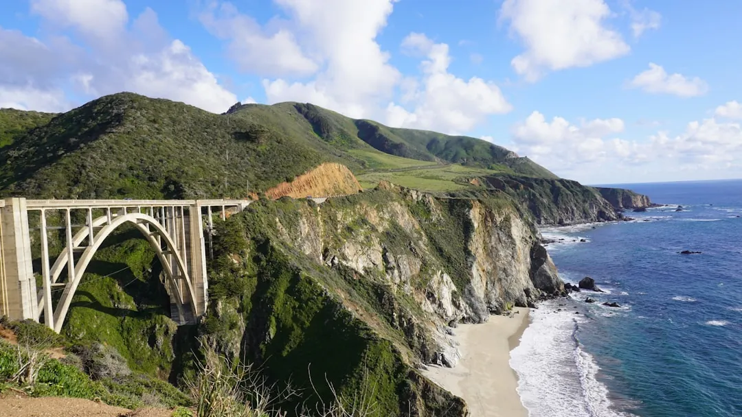
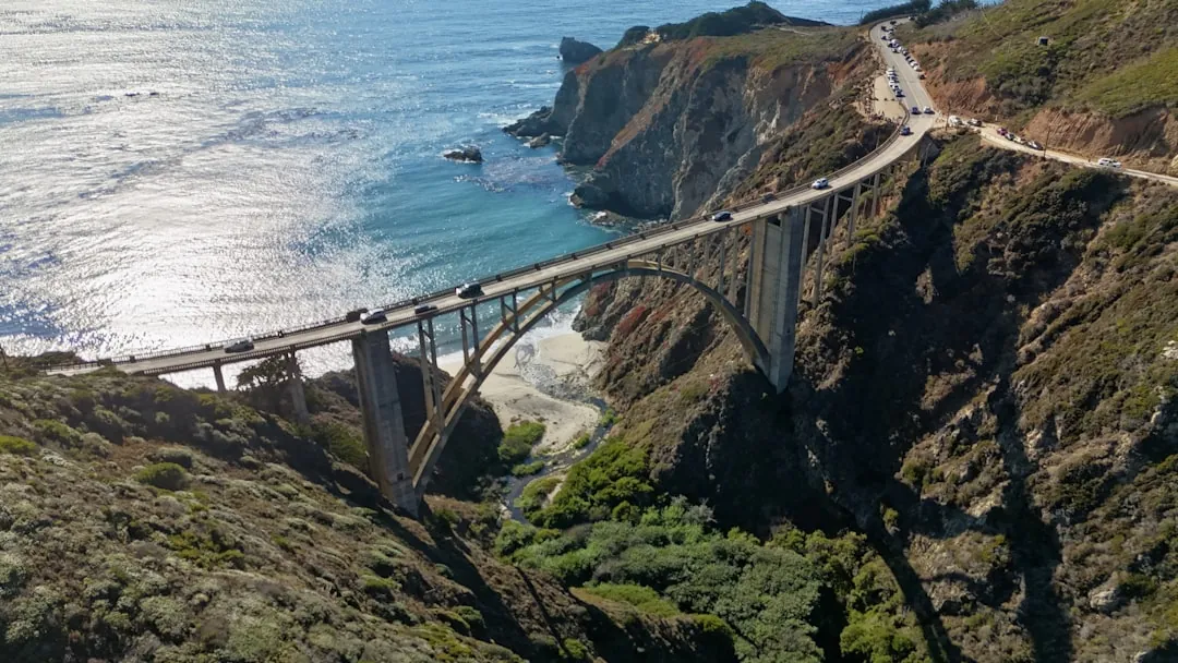
You come around a bend south of Monterey and the road just — stops. Not stops in traffic. Stops in the sense that the view takes the steering out of your hands. The Bixby Bridge arcs a single span across a chasm, the ocean white-foamed a hundred feet below, and for a second you forget you are supposed to be driving. That is the Pacific Coast Highway, signed for most of its length as Highway 1, and it runs the edge of the continent for hundreds of miles — surf beaches, sea cliffs, fishing towns, and some of the most-photographed horizons in North America.
Route Overview
Most first-timers drive the Big Sur / central coast stretch, usually between Santa Monica and San Francisco, a distance of roughly 450 miles. Four to six days gives you room to stop at will; two days is possible but feels like a delivery route. If you can stretch it, stretch it — the whole point is the pull-offs.
| Segment | Approx. Time | Highlight |
|---|---|---|
| Santa Monica to Santa Barbara | 1.5–2 hrs | Malibu beaches & vineyards |
| Santa Barbara to San Luis Obispo (via 1) | 2.5–3 hrs | Pismo Beach, coastal bluffs |
| San Luis Obispo to Big Sur | 1.5–2 hrs | Morro Rock, Ragged Point |
| Big Sur to Monterey | 2–3 hrs | Bixby Bridge, McWay Falls |
Must-See Stops Along Highway 1
Malibu & the Santa Monica Mountains
Head north from Santa Monica past a string of beaches. Point Mugu State Park lines up easy coastal hiking, and the Malibu vine-loop adds a tasting pause you won't regret.
Santa Barbara
A Spanish-colonial city with a red-tile waterfront and a mission straight out of a postcard. It feels more Mediterranean than Californian, and it makes a fine first night's stop.
San Luis Obispo & Morro Bay
A university town with a lively downtown. Just north, Morro Rock rises off the bay and the village beside it makes for a slow, scenic afternoon.
Big Sur
The centerpiece — and it deserves a full day. The key sights:
- Bixby Creek Bridge — the famous single span, the photo everyone comes for.
- Pfeiffer Big Sur State Park — redwoods and a river canyon.
- McWay Falls (Julia Pfeiffer Burns State Park) — a waterfall dropping straight onto a beach.
- Pfeiffer Beach — purple-tinted sand and sea arches; reservation needed in season.
Monterey & Carmel
End the Big Sur leg in Monterey for the Aquarium and Cannery Row, or in Carmel-by-the-Sea, all cobblestones and cypress. From here Highway 1 rolls past Santa Cruz toward Half Moon Bay and San Francisco.
Best Time to Drive the Pacific Coast Highway
Because so much of the route clings to steep bluffs, late spring to early autumn is the safe, clear window. Summer (June–August) dries the roads and stretches the daylight, though mornings along the coast can sit under fog until mid-day. September's "second summer" often delivers the clearest skies of the year. Winter and early spring run quiet but bring rain, and the occasional slide can close a section for weeks.
Highway 1 vs Highway 101: Which Follows the Coast
Two great state highways hug the Pacific, and they’re very different creatures. Knowing the difference helps you pick the right one for the day.
- Highway 1 (Pacific Coast Highway) — the famous cliff-hugging route: slow, dramatic, with the ocean almost always in view. Ideal for Big Sur and the Central Coast, but it demands time and patience around the hairpins.
- Highway 101 — the faster inland companion that shadows the coast, threading through cities, redwood groves and wine country. On the North Coast, after Highway 1 wraps up, 101 becomes the main scenic corridor.
Driving Tips
- Fuel up early. Gas is scarce and expensive between the towns on the Big Sur stretch.
- Use the pull-outs. Slow down and stop at the designated overlooks — never on the roadway itself.
- Give cyclists room. The route is a cycling favorite; be generous with the shoulder.
- Don't rush it. The appeal is the journey, so budget extra time and stop often.
- Book lodging well ahead. Big Sur has few hotels and they book out far in advance.